As a company specializing in drones, our services include photogrammetry. Photogrammetric surveys allow us to provide many functional solutions for surveyors and architects, which we present below.
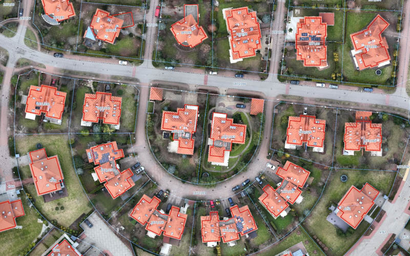
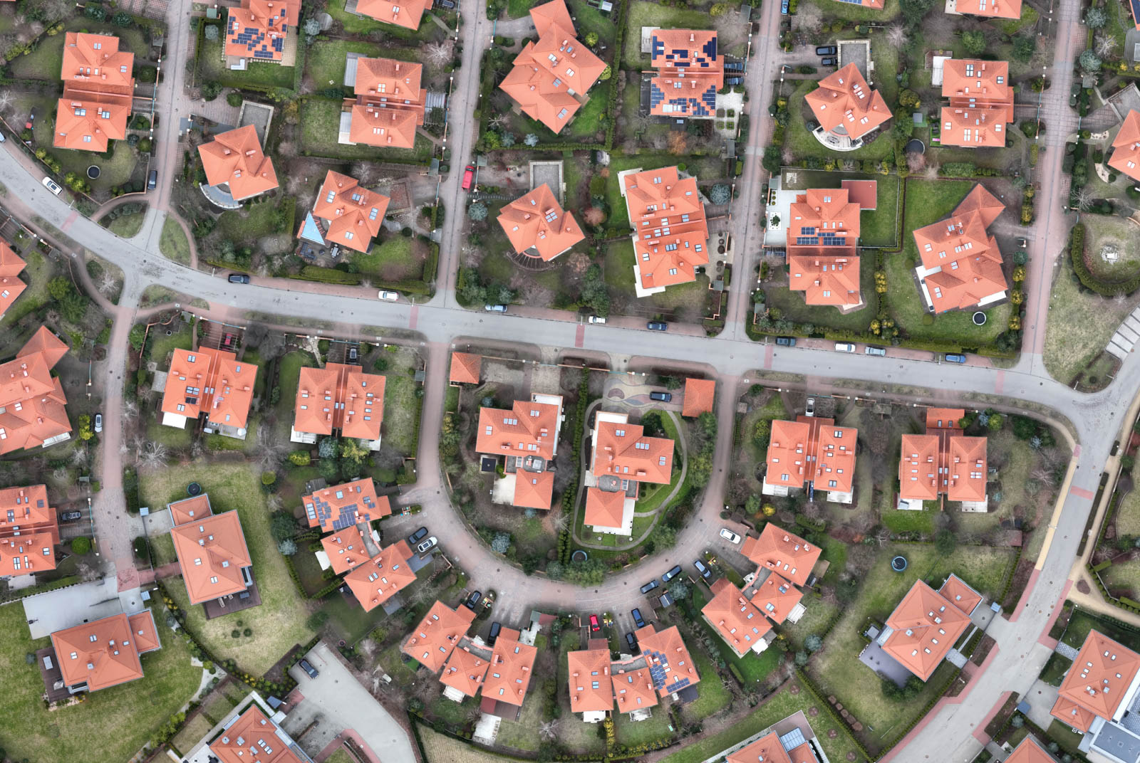
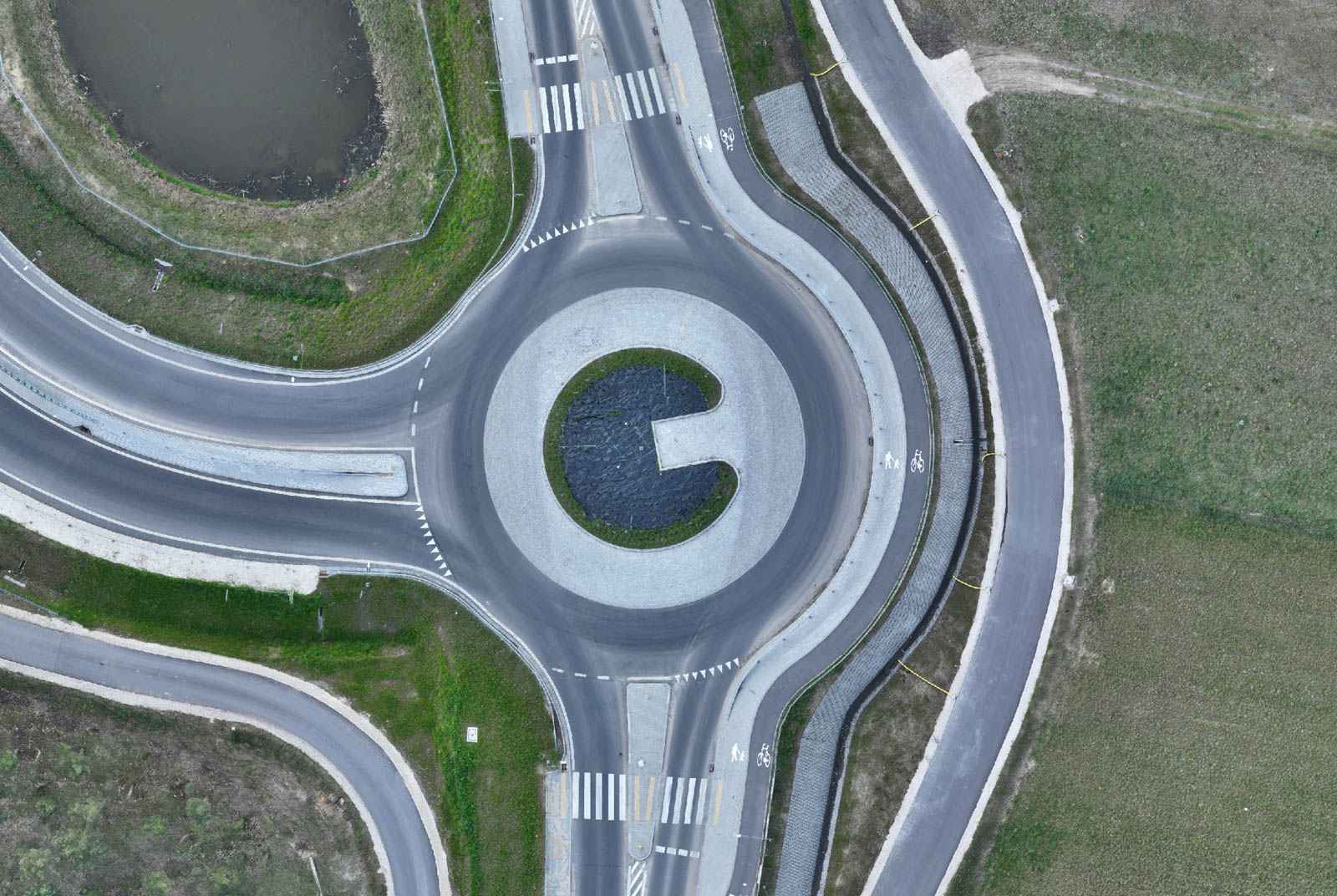
ORTHOPHOTO MAPS
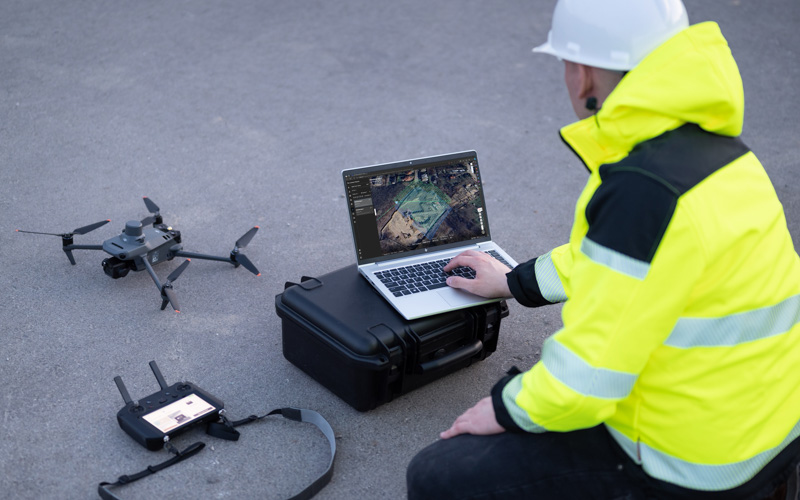
drone mapping
We carry out flights by taking sequences of several hundred or even thousands of photos, which are processed in professional software to generate an orthophoto map. Thus, an orthophoto map is not just a regular photo from a drone.
We create orthophoto maps using a modern fleet of drones equipped with precise RTK modules, allowing for centimeter-level accuracy, thereby ensuring high measurement precision for various projects.
Importantly, on the orthophoto maps we prepare, spatial analyses can be conducted (such as performing control measurements), or other digital layers can be overlaid in GIS software (for example, a cadastral map of plots can be overlaid on the orthophoto map for verification and delineation of land property boundaries or a vector construction plan can be overlaid on the orthophotomap and thus analyze the progress of construction works).
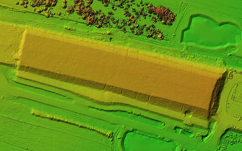
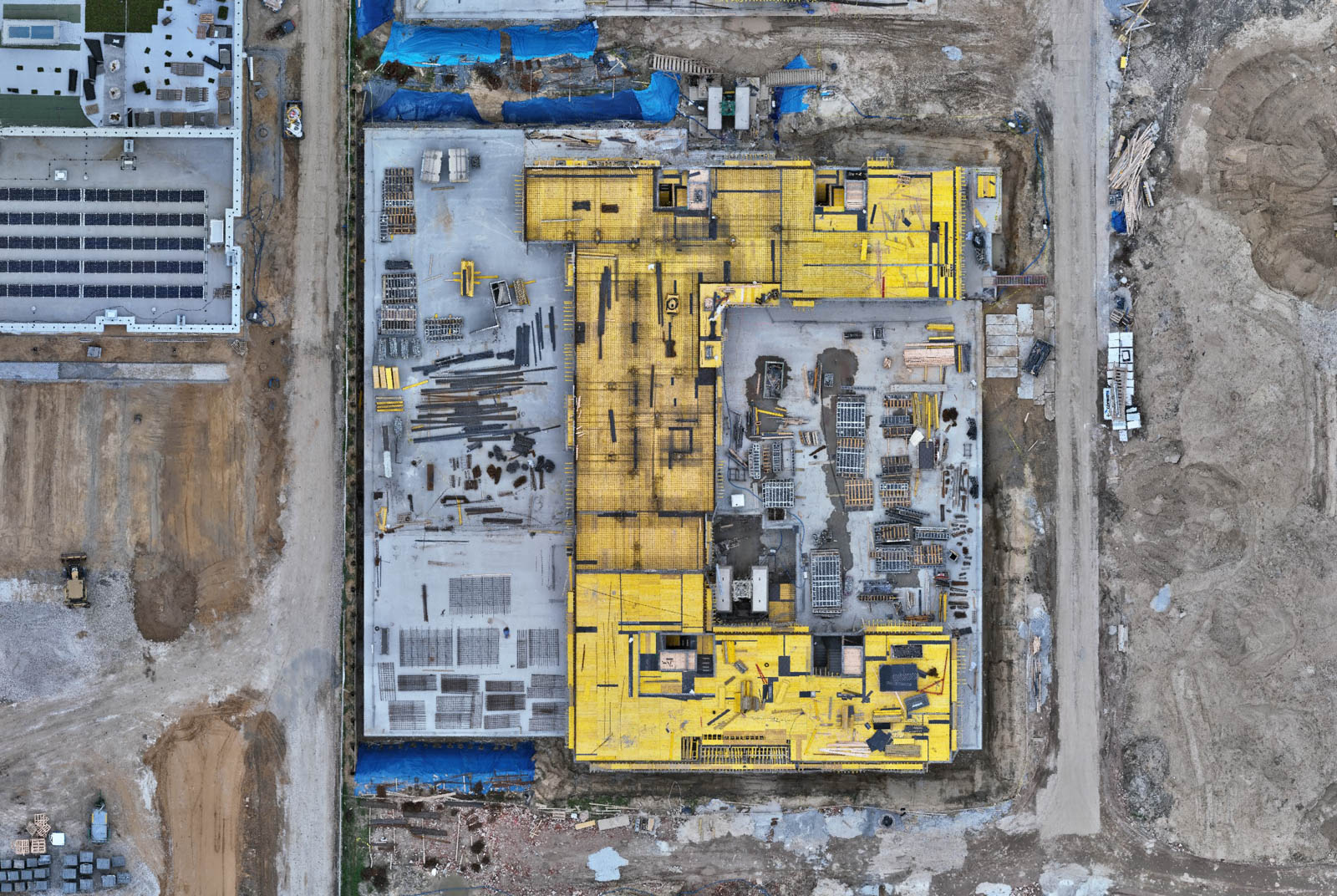
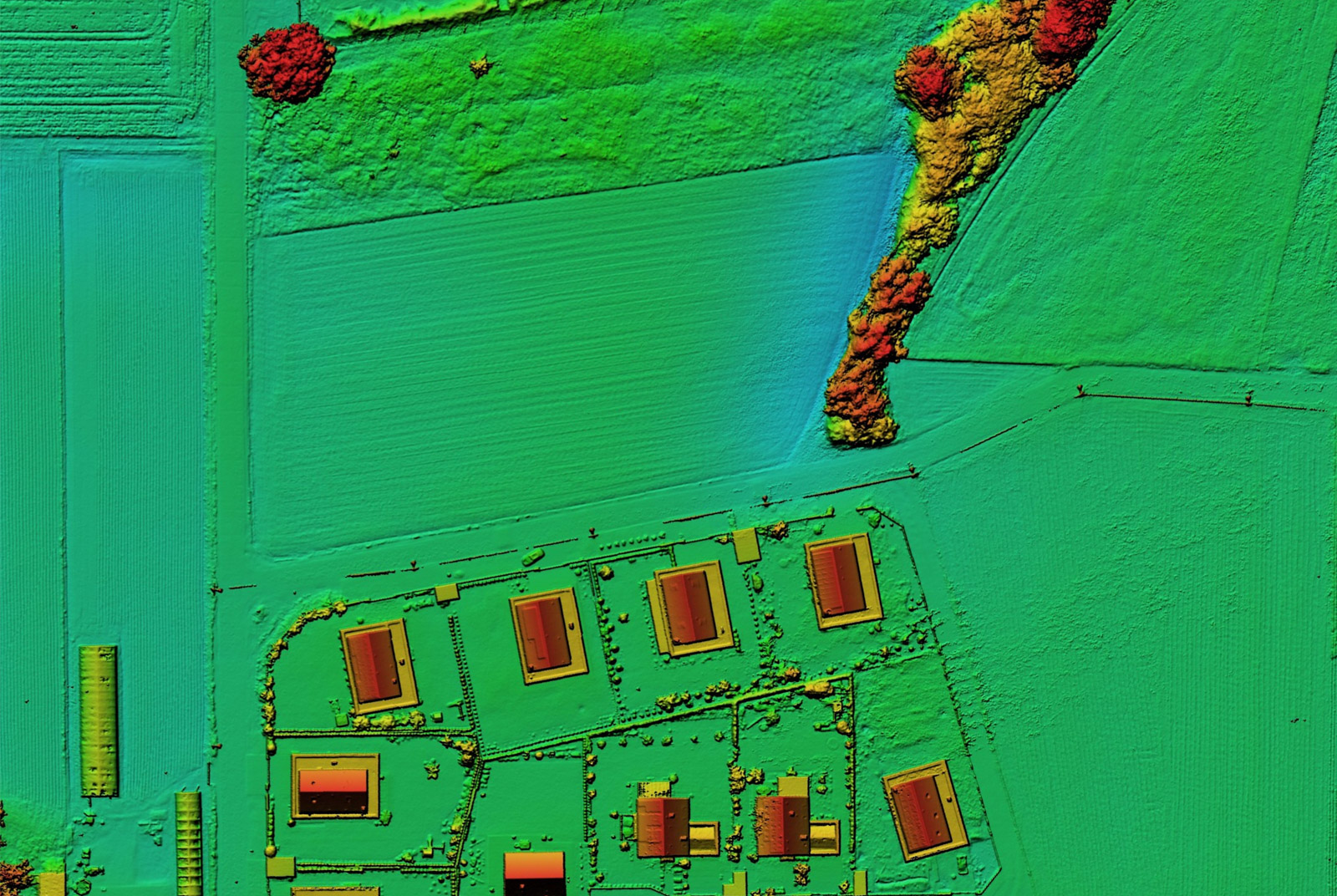
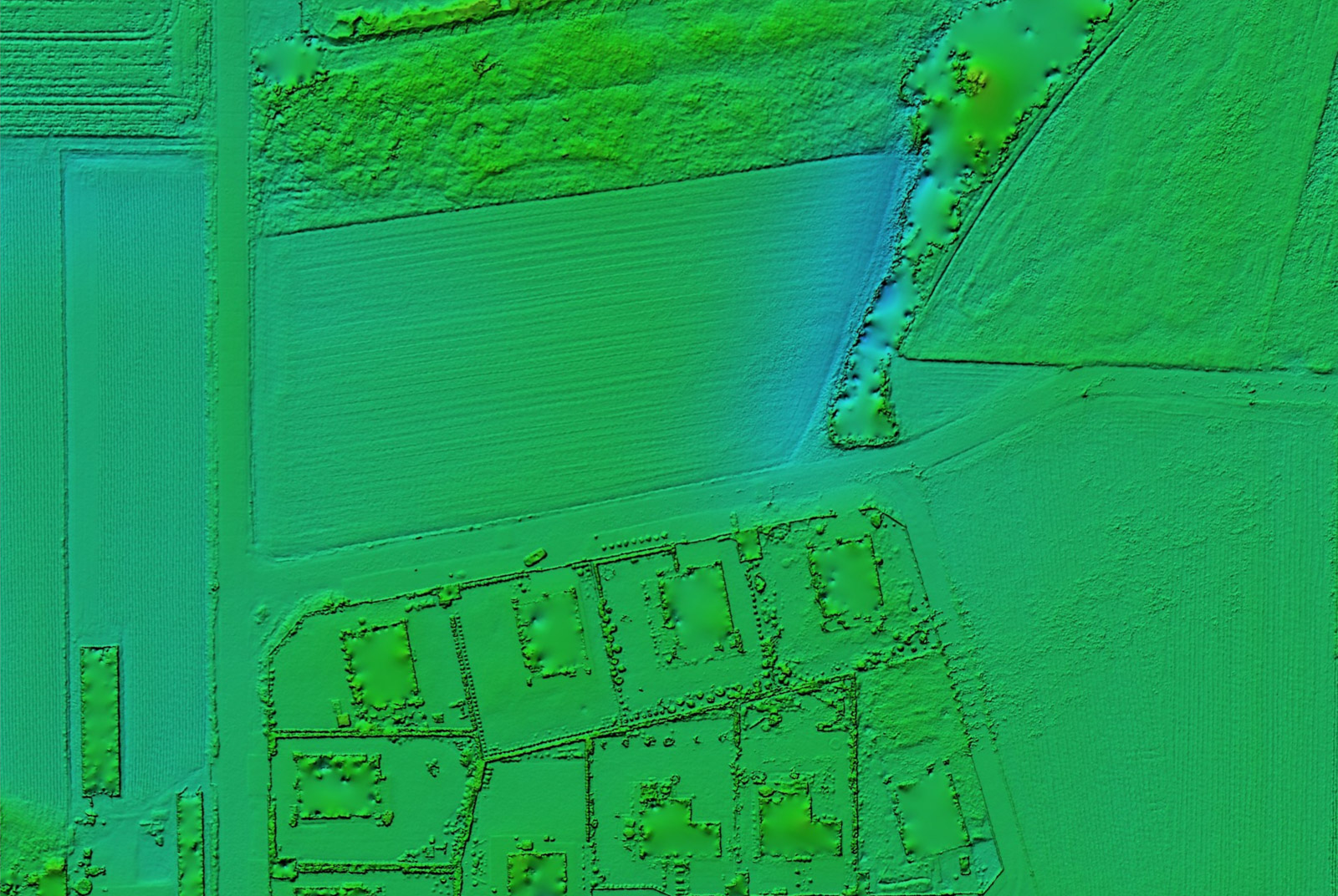
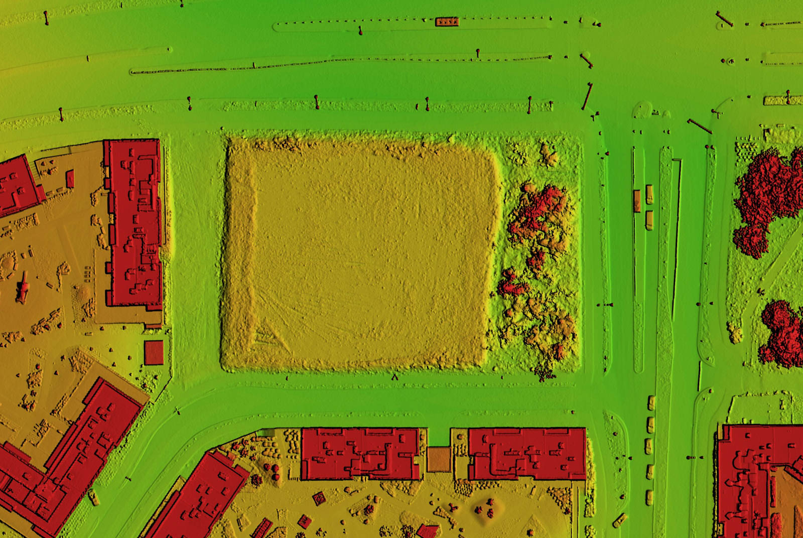
DIGITAL SURFACE MODELS
TERRAIN IRREGULARITIES measurement
The result of further processing can be generating a digital surface model which accurately represents the terrain's elevation, including all slender elements rising above the ground surface (such as buildings, ruins, trees).
Analysis of this model helps identify terrain irregularities that may require earthworks and land leveling (such as ditches, holes, hills). Using these models, we can also estimate the volume of earthworks. Additionally, cross-sections can be made to analyse the quality of work carried out (e.g. excavations).
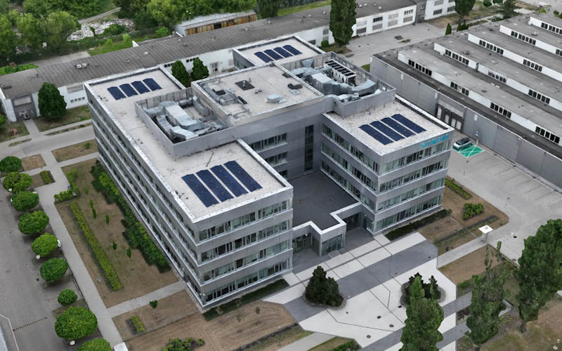
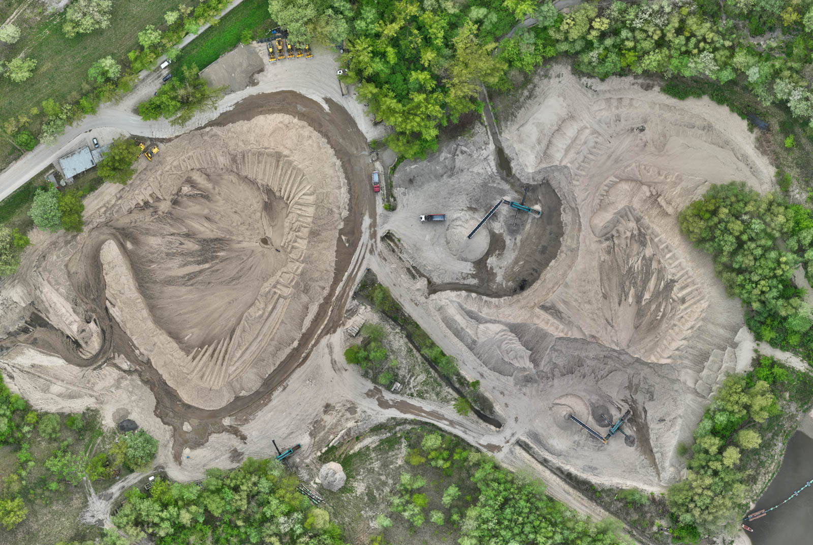
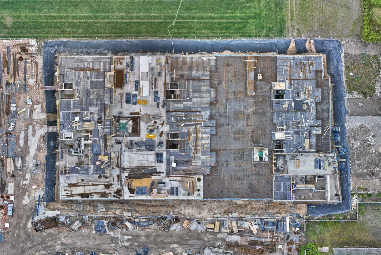
3D Models
Digital twin
Data obtained from drone surveys also allow for very precise measurement of terrain or structural details directly on 3D models.
Creating virtual copies enables better visualization and analysis (for example, it allows not only for measuring distances but also for calculating volume, and even for accurately measuring the height of individual trees). For this reason, creating 3D models is useful in surveying inventories.
Such a solution saves time and resources that would otherwise be spent on analyzing building plans, manual dimensioning, searching for documentation, and field visits.
Generating 3D models from drone flights allows for precise measurement of the volume of earth masses, sand mounds, and aggregates on the construction site. This enables the estimation of the cost and time of removal, assessment of stock levels, and comparison of supply compliance with orders.
EXPERIENCE
OUR PROJECTS

EQUIPMENT
HIGH LEVEL OF ACCURACY
We use a modern fleet of drones equipped with precise RTK modules, allowing for centimeter-level accuracy, thereby ensuring high measurement precision for various projects.
As a result, all of our photogrammetric products — orthophoto maps, digital surface models, or 3D models — are characterized by high-quality representation, enabling precise spatial analysis.
We conduct our flights in autonomous mode, which is carefully planned and tailored to the specific requirements of the task (e.g., whether it is a nadir flight for an orthophoto map or an oblique flight for a 3D model).
HOW DO WE WORK?
Drone mapping step by step
The initial stage is a conversation with the client, during which we determine their requirements (e.g. what the GSD should be - the size of the ground pixel and whether we should additionally perform spatial analyses). This information is important for pricing the drone mapping service.
The next step is to plan the drone flight route in terms of the task being performed (e.g. whether it is to be a nadir flight only for the orthophotomap or an oblique flight for the 3D model). If you need to obtain special authorization from the relevant authorities to perform the flight, we also take care of obtaining it.
Then our experienced pilots conduct a photogrammetric drone flight, during which hundreds, sometimes even thousands, of photos are taken. Each of our drone flights is conducted with rigorous safety precautions.
After the flight, we generate the appropriate photogrammetric product – an orthophoto map, a digital surface model, or a 3D model, by processing the photos in professional software.
Finally, we deliver the results to the client according to their preferences, making them available through an online portal or directly as a downloadable file (e.g., in GeoTIFF format).
What’s worth knowing?
Frequently Asked Questions
How much does drone mapping cost?
The price of a drone mapping service depends on many factors, such as: the type of implementation (orthophotomap, digital terrain model or 3D model?), the area to be mapped, travel costs (what location?). Please contact us to get an accurate quote tailored to your specific needs and expectations related to drone mapping services.
Will I receive an invoice?
Yes, we issue invoices without VAT.
How will I receive the content generated from drone mapping?
Materials generated as a result of drone mapping (orthophotomaps, digital terrain models, 3D models) are available for download via cloud drive.
We are ready to map your area with a drone
Get a free quote
Contact
+48 792 123 215
dronox@dronox.pl
DronoX
Marcin Redziński
Olczyska 4
02-828 Warszawa
NIP: 9512189778
REGON: 389749268